Last Updated on June 12, 2024 12:38 pm by Laszlo Szabo / NowadAIs | Published on June 12, 2024 by Laszlo Szabo / NowadAIs
Google Maps AI: What to Expect from the Classic Upgraded with AI? – Key Insights
- Google Maps is integrating new AI technology to changenavigation and exploration experiences
- New features like Immersive View, Lens in Maps, and AI-powered search are set to redefine how we interact with and discover the world around us
- Developers can now leverage Gemini model capabilities in the Google Maps Platform to provide more personalized and contextual place information to users
- AI-driven enhancements in Google Maps promise to make our journeys more efficient, sustainable, and tailored to individual preferences
Introduction
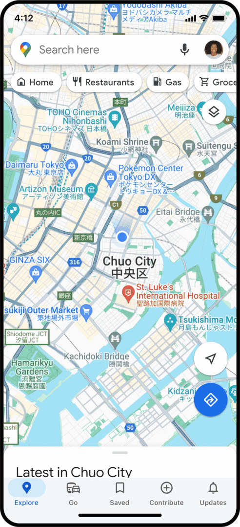
In the rapidly evolving digital landscape, where technology has become an integral part of our daily lives, the role of artificial intelligence (AI) continues to expand in unprecedented ways. And now, the ubiquitous Google Maps is poised to harness the transformative power of AI to redefine the very essence of navigation and exploration.
Over the years, Google Maps has cemented its position as an indispensable tool, guiding millions of users through the complexities of urban landscapes and remote destinations. However, the platform’s latest advancements, powered by cutting-edge AI, are set to elevate the user experience to unprecedented heights. From immersive route previews to intelligent search capabilities, these innovations promise to reshape how we interact with and discover the world around us.
Now we’ll delve into the captivating world of Google Maps AI, exploring the groundbreaking features that are poised to change the way we navigate and explore our surroundings. Prepare to embark on a journey where technology and human curiosity converge, unlocking a future of seamless, personalized, and sustainable mobility.
Immersive View: Visualizing Your Journey
Imagine being able to preview your route in stunning, multidimensional detail before you even set foot outside. That’s precisely what Google’s Immersive View for Routes aims to achieve. By harnessing the power of AI and fusing together vast troves of Street View and aerial imagery, this revolutionary feature allows users to visualize their journey from start to finish.
Whether you’re driving, cycling, or walking, Immersive View provides a captivating preview of the terrain, landmarks, and even simulated traffic and weather conditions along your route. This level of detail empowers users to make informed decisions, plan their trips accordingly, and avoid potential pitfalls, such as heavy congestion or inclement weather.
Stepping into this immersive experience is as simple as requesting directions and tapping the Immersive View preview in the Google Maps app. Users can then navigate through the virtual landscape, preparing for each turn and maneuver as if they were already on the ground. This seamless integration of technology and user experience sets a new standard for route planning, making the journey as engaging as the destination.
Lens in Maps: New Navigation and Exploration
Imagine standing on a bustling street corner, unsure of your surroundings, and suddenly being able to point your phone’s camera at a nearby landmark or building to instantly uncover its identity, history, and relevant information. This is the power of Lens in Maps, a groundbreaking feature that blends augmented reality (AR) with Google’s advanced image recognition capabilities.
By simply tapping the Lens icon in the Google Maps search bar and pointing your camera, you can instantly access a wealth of contextual information about your immediate environment. Whether you’re looking for the nearest coffee shop, curious about a historic building, or trying to orient yourself in a new city, Lens in Maps provides real-time insights and guidance, seamlessly overlaying digital information onto the physical world.
This innovative feature not only enhances navigation but also opens up new avenues for exploration. Users can now discover hidden gems, local hotspots, and unique experiences by simply scanning their surroundings, empowering them to venture beyond the well-trodden paths and uncover the true essence of a destination.
Detailed Navigation Assistance
Navigating the complexities of urban environments can be a daunting task, especially when it comes to maneuvering through intricate road networks and avoiding potential hazards. Google Maps’ revamped navigation toolkit, powered by AI, steps in as a trusty co-pilot, ensuring users stay on course effortlessly.
One of the key enhancements is the introduction of lane guidance, which provides users with detailed information about the appropriate lanes to use for their destination. This feature is particularly valuable in situations where last-minute lane changes or merging maneuvers are required, helping drivers stay focused and confident behind the wheel.
Moreover, Google Maps’ integration with real-time traffic data allows the platform to offer accurate and up-to-date information about road conditions, congestion, and potential disruptions. Users can now make informed decisions about their routes, opting for alternative paths or adjusting their departure times to avoid delays and ensure a smooth and efficient journey.
Aerial View API: Elevating Digital Experiences
As the world becomes increasingly interconnected, the demand for innovative and immersive digital experiences has never been higher. Google’s Aerial View API, powered by AI, is poised to revolutionize how developers and businesses can integrate captivating 3D bird’s-eye perspectives into their applications and websites.
This technology enables the creation of stunning, photorealistic 3D renderings of cities, landmarks, and landscapes, providing users with a unique and engaging way to explore their surroundings. By leveraging the vast troves of satellite imagery and advanced computer vision algorithms, the Aerial View API allows developers to seamlessly incorporate these breathtaking visuals into their digital offerings.
Whether it’s a real estate platform showcasing property listings, a travel app highlighting must-see destinations, or a city planning tool visualizing urban development, the Aerial View API empowers developers to elevate the user experience and offer a new level of immersion and interactivity. This innovative technology not only captivates users but also has the potential to enhance decision-making, facilitate urban planning, and foster a deeper understanding of the world around us.
Visual-Centric Search: Discovering the World through Imagery
In the age of visual-driven content, Google Maps is embracing the power of imagery to transform the way users search for and discover new places. Leveraging the vast trove of user-generated photographs and advanced image recognition algorithms, the platform is introducing a groundbreaking visual-centric search experience.
Imagine searching for “animal latte art” or “pumpkin patch with my dog” – instead of a traditional text-based list of results, users will be presented with a visually-driven carousel of relevant places, showcasing stunning photographs that capture the essence of their query. This innovative approach allows users to quickly identify and explore the most visually appealing and fitting options, making the discovery process more intuitive and engaging.
Moreover, the integration of these image-first search results directly onto the map interface enhances the overall navigation experience. Users can now seamlessly transition from browsing captivating imagery to accessing detailed information about a particular location, seamlessly blending the visual and informational aspects of their exploration.
This visual-centric search functionality not only caters to the needs of visual learners but also taps into the inherent human tendency to be drawn to visually compelling content. By harnessing the power of AI and the collective visual insights of the Google Maps community, this feature promises to redefine how we explore and discover the world around us.
Spontaneity and Sudden Plan Changes
In the fast-paced world we inhabit, the ability to adapt to unexpected circumstances and sudden plan changes has become increasingly important. Google Maps, with its AI-powered capabilities, is rising to the challenge, empowering users to navigate the unexpected with ease and confidence.
Imagine you’re planning a day of exploration in a new city, but the weather takes an unexpected turn. Rather than being deterred, you can simply ask Google Maps for “activities for a rainy day” and receive a curated list of indoor options tailored to your location. Whether it’s a cozy art gallery, an interactive museum, or a lively comedy show, the platform’s AI-driven recommendations will ensure your day remains filled with engaging and enjoyable experiences.
Similarly, if you find yourself in a situation where your original plans need to be adjusted, Google Maps’ AI-powered search can help you quickly identify alternative options that cater to your evolving needs. Perhaps you’re craving a vegan lunch after a morning of thrifting, or you need to find a dog-friendly activity to include your four-legged companion – the platform’s contextual search results will provide personalized suggestions, seamlessly adapting to your changing preferences.
This level of flexibility and responsiveness, powered by the integration of AI, transforms Google Maps into a true personal assistant, empowering users to embrace spontaneity and navigate the unexpected with ease. Whether you’re a seasoned explorer or a spontaneous adventurer, this feature ensures that your journeys remain fluid, engaging, and tailored to your ever-evolving needs.
Definitions
- Google Maps: A web-based service developed by Google that offers detailed information about geographical regions and sites around the world, including maps, satellite views, and street views.
- Augmented Reality (AR): A technology that superimposes digital information, such as images and sounds, onto the real world, enhancing the user’s perception of their environment.
- Immersive View: A feature in Google Maps that allows users to visualize their routes in detailed, multi-dimensional previews using AI to combine Street View and aerial imagery.
- Lens in Maps: A functionality in Google Maps that utilizes AR and image recognition to provide real-time contextual information about the user’s surroundings by pointing the phone’s camera at landmarks or objects.
Frequently Asked Questions
- What is Google Maps AI? Google Maps AI refers to the integration of artificial intelligence into Google Maps to enhance navigation and exploration experiences. This includes features like Immersive View, AI-powered search, and Lens in Maps, which provide more personalized and contextual information.
- How does Immersive View in Google Maps AI work? Immersive View combines Street View and aerial imagery to create a multi-dimensional preview of your route. It allows users to visualize terrain, landmarks, and simulated traffic and weather conditions, helping them plan their trips more effectively.
- What is Lens in Maps and how does it enhance navigation? Lens in Maps is an AR feature that lets users point their phone’s camera at a landmark or building to instantly access its identity, history, and other relevant information. This enhances navigation by providing real-time, contextual insights about the user’s surroundings.
- How does Google Maps AI improve search functionality? Google Maps AI enhances search functionality with visual-centric search results. Instead of traditional text-based results, users see a carousel of images related to their query, making it easier to identify and explore visually appealing and relevant places.
- What benefits do AI-driven enhancements in Google Maps offer to users? AI-driven enhancements in Google Maps provide more efficient and sustainable journeys, detailed navigation assistance, and personalized recommendations. These features help users adapt to changing plans and discover new places based on their preferences and current conditions.